Visualisation
A picture paints a thousand words and a carefully considered visual can make all the difference at any stage of a project.
Visualisation is more than a design tool, it’s a science. The right image can cut through complexity, translate ideas, and ground projects in advocacy and evidence. When accuracy supports creativity, visuals don’t just look good – they stand up to scrutiny and drive better decisions.
Our team doesn’t create imagery as decoration. We craft visuals to engage, persuade, and clarify. From quick sketches and diagrams to photomontages and high-fidelity renders, each piece is designed to capture intent, reveal vision, and give weight to evidence across landscape architecture, urban design, strategic planning, and development advisory.
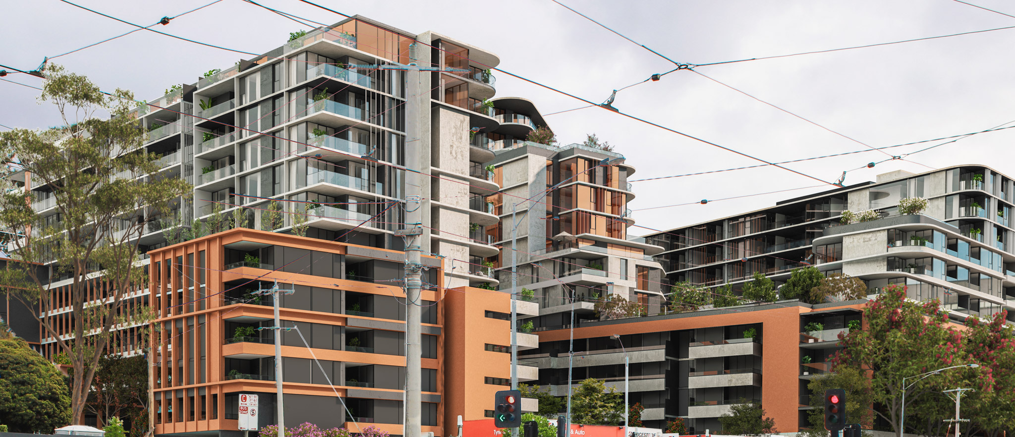
Photomontage
A photomontage is a technical visualisation that provides an accurate representation of how a development proposal will appear in its real-world setting, prior to approval or construction.
Well-prepared images remove the guesswork, offering clarity for decision-makers and stakeholders. Our photomontages are prepared to industry best-practice standards, including those set by VCAT and other authorities, and support clear, confident decision-making.
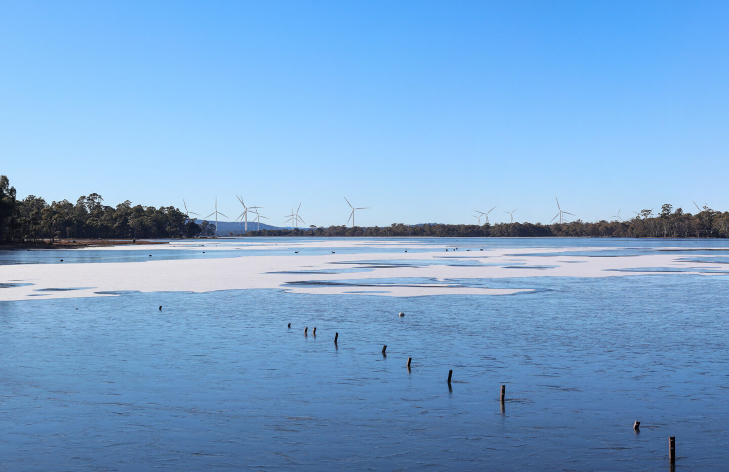
Viewshed Assessment
A viewshed assessment is a digital analysis used to identify where a proposed development may be visible within the surrounding landscape.
Using topographical data and 3D modelling software, it maps sightlines from specific viewpoints, making it a valuable tool for development planning and Landscape and Visual Impact Assessments.
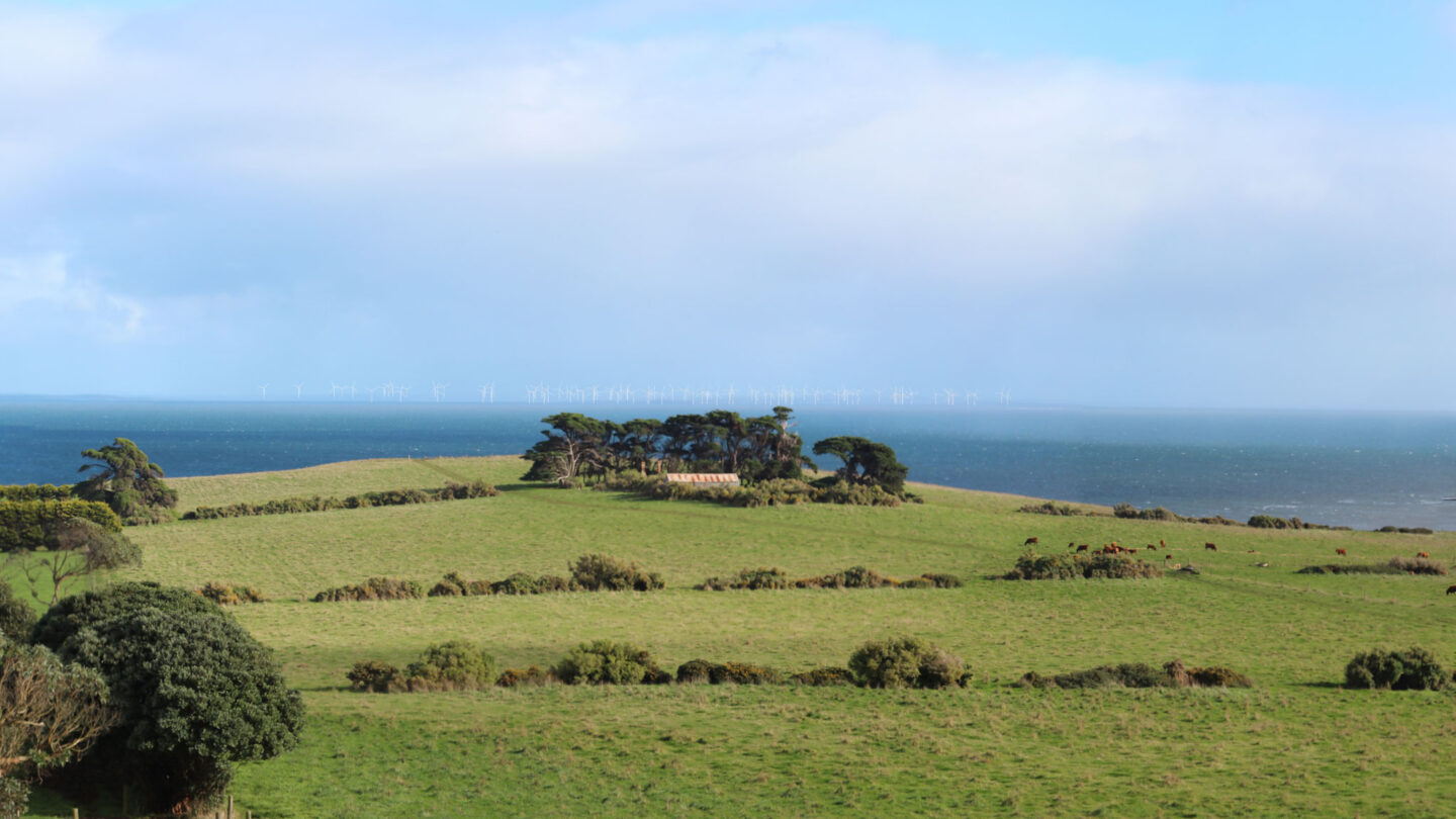
Landscape and Visual Impact Assessment
Landscape and Visual Impact Assessment (LVIA) identifies and evaluates the effects of development proposals on the surrounding landscape and the visual amenity experienced by people within it.
LVIA is essential in assessing developments of all sizes, with particular importance for large-scale projects requiring Environment Effects Statements (EES) or Environmental Impact Statements (EIS).
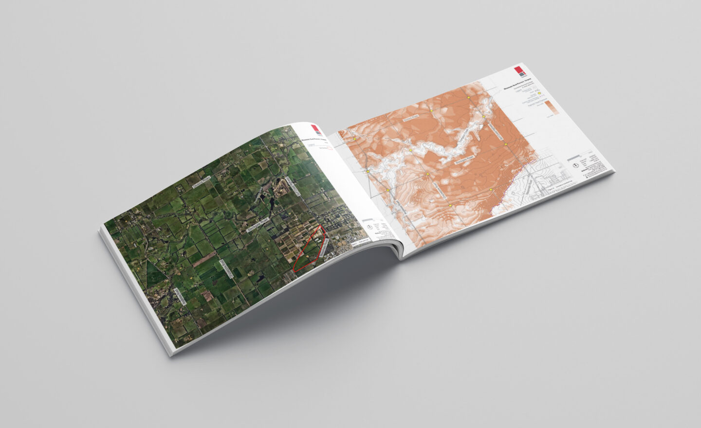
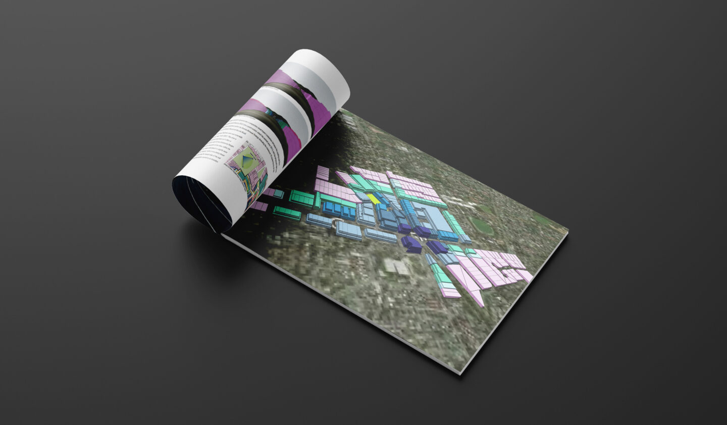
Built Form Modelling
Built form modelling is a key tool for shaping new developments and informing strategic planning for precincts and activity centres.
It serves many purposes, including assessing building heights, plot ratios, massing, overshadowing effects, floorspace yields, and visual impacts at street level.
At Hansen, we utilise built form modelling throughout the design process to test and evaluate optimal outcomes. It also acts as an effective communication tool.
Artist Impressions
We offer a full and varied spectrum of graphic and representative outputs to illustrate different aspects or impressions of a project. From hand drawn sketches or photo realistic computer renders. These visuals convey the design in a more emotive, accessible way, complementing technical drawings.
We work closely with clients to choose the visual approach that best represents the design intent and project outcome.
Expert Evidence
Hansen’s senior team members are highly experienced in the preparation and presentation of expert evidence, including the fields of Landscape and Visual Impact Assessment (LVIA), photomontage, built form modelling and shadow analysis.
This expertise draws on strong technical competence with specialised software packages, combined with many years of experience as urban designers and landscape architects working across the planning and development sector.
Yield / Capacity Assessments
Understanding a site or precinct’s potential highest and best use is a key part of due diligence, site selection, and assessing an area’s capacity for change.
Drawing on our planning and urban design expertise, we prepare technically robust assessments that support strategic studies, site identification, feasibility analysis, and valuations.
Our yield and capacity assessments are also presented as clear, accessible 3D massings, providing a straightforward view of possible future outcomes.
Shadow Analysis
As our urban environments become denser, the importance of maintaining good solar access to key streets and public parks is amplified.
Utilising our 3D modelling skills, Hansen can quickly and accurately demonstrate a proposal’s overshadowing impacts and expertly assess whether not or it is appropriate.
Featured Projects


Joanna Spiez
Associate - Landscape Architecture

With over 15 years of experience as a Landscape Architect in both the private and public sectors, Joanna has worked on diverse landscape architecture projects across three countries. Her global experience brings a unique perspective to every project, blending sustainable and environmentally conscious design principles with a passion for creating functional and aesthetically pleasing spaces.
Joanna’s portfolio spans a wide range of projects throughout Melbourne, including large-scale public parks, residential estates, urban renewal initiatives, and commercial developments. She has a deep understanding of the entire design process, from concept to completion, and ensures every project is delivered with attention to detail and a commitment to quality.
Collaborating with developers, contractors, local authorities, and community stakeholders, Joanna excels at aligning project goals with client expectations. Her strong communication skills allow her to convey complex design concepts clearly, ensuring that each project not only meets its requirements but also enhances the surrounding environment.
- Recreational open space & play space design
- Masterplanning
- Public domain and streetscape design
- Multi-use residential and commercial design
- Kindergartens and Community Spaces
- Detailed design
- Graphic and documentation production
- Landscape Illustration